


Risk of severe thunderstorms tonight in Hamilton
Published July 26, 2023 at 11:24 am

Hamilton could see severe thunderstorms tonight as the city experiences a heat wave.
The Weather Network forecasted that an incoming squall line, or a line of thunderstorms, will move into southwestern Ontario on Wednesday evening, bringing the risk of damaging winds, possibly “toonie-sized” hail, and the chance of a few Quasi-Linear Convective System tornadoes, which form with little warning.
The Weather Network did not report the risks of large hail and tornadoes for Hamilton specifically, noting they were a general risk for the southwestern region of the province.
Hamilton’s Medical Officer of Health issued a heat warning for the city starting today (July 26). Hot and humid conditions are expected until Friday.
For information on where to cool down in the city and more advice, visit www.hamilton.ca/heat
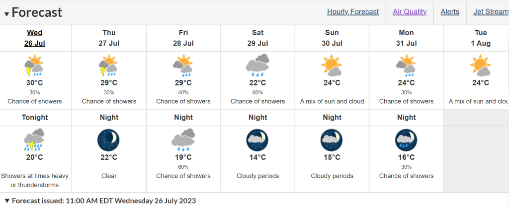
Wednesday will see a mix of sun and cloud with a 30-per-cent chance of showers later in the afternoon in Hamilton, according to Environment Canada. The high will be 30 C with a humidex of 36. The UV index is “very high” at 9.
There will be showers including a few thunderstorms early this evening, which will be heavy at times. After midnight, there’s a 30-per-cent chance of showers, which could amount to 30 to 40 millimetres.
The forecast for Thursday is mainly cloudy with a 30-per-cent chance of showers in the morning with a risk of a thunderstorms. The high is 29 C with a humidex of 37, and very high UV index of 8.
ENVIRONMENT CANADA